
Start a Mount Pleasant Street Directory Search
Address-first work avoids a common-name trap. USPS can standardize the street and unit, then the City of Mt Pleasant parcel system can turn that address into a parcel number. Isabella County GIS adds the parcel outline and nearby parcels. The legal description from those sources gives the Isabella County Register of Deeds index a stronger search key than a street name alone. A result on one system should be treated as a lead for the next system, not as a complete statement about a household.
- Run the street through USPS ZIP Lookup and retain the standardized address, unit and ZIP. USPS says its result does not confirm a person or company at the address.
- Search the address in BS&A Online City of Mt Pleasant municipality 226. Note the parcel number, tax year and the route used to reach the record.
- Open the same parcel in Isabella County FetchGIS. Save the map theme and date before using the map to compare road and parcel context.
- Use the parcel number, legal description, former owner, subdivision, or document number in the Register of Deeds index. Read the document type before treating an instrument as a transfer.
- For a dated household clue, check the historical volumes and newspapers held through CRDL and Clarke. The Mount Pleasant city directory collections explain the older shelf in more depth.
That order keeps the task narrow. A tax display can name an owner or taxpayer, but it does not establish who was physically present. A voter record can address registration, while a directory can place a household at an address for one edition. Each answer needs its date and custodian.
Normalize Mount Pleasant Street Addresses First
USPS offers By Address, By City and State, and Cities by ZIP modes. Its address form uses an optional company field, a required street address, an apartment or suite field, city and state, and an optional ZIP. Record the answer exactly as returned. A postal match is useful because old records can abbreviate or spell a street differently, but it is a mailing check rather than proof of residence.
Mount Pleasant has three postal references that need different treatment: 48804 is associated with PO Box references, 48858 is the general city and main post-office reference, and 48859 is associated with Central Michigan University. ZIP geography does not establish a parcel, city limit, precinct, school district, or legal description. For a street directory search, use the postal result to normalize a search, then use BS&A and county GIS to establish local geography.
Note: Retain the search date because postal formatting and a standardized street spelling can change over time.
Search Mount Pleasant Parcels in BS&A
The city-specific address layer is BS&A Online municipality 226. It offers Address, Name and Parcel Number fields, followed by Detailed Record Search, Current Tax Search, Assessing Search, Property Sale Search, utility, and building-related routes. The portal presents its material as a reference and directs users to contact the municipality about an error. Its screen did not expose a coverage-date range, so save the displayed tax year rather than assuming a time span.
| BS&A field or route | Use by street | Result to preserve |
|---|---|---|
| Address | Find a city parcel from a normalized street and number. | Returned address and parcel number. |
| Name | Check whether a parcel record uses a known owner or taxpayer name. | Exact search spelling and result date. |
| Parcel Number | Return to the same parcel after mapping or deed research. | Parcel identifier and municipality 226. |
| Current Tax / Assessing | Separate a yearly tax or assessment view from the deed trail. | Tax year, class, assessed, SEV and taxable values when shown. |
| Property Sale Search | Locate a sale-oriented route before checking the underlying instrument. | Search date and a link to the recorded document when available. |
BS&A Online for Mount Pleasant shows the address, name and parcel choices used in the city property search.
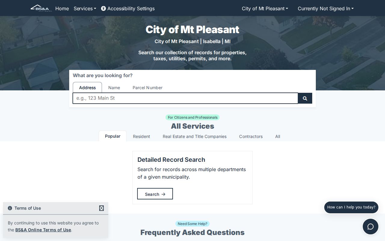
The screen is most useful as a handoff point. It ties a street address to the parcel identifier that can be checked on a map and against a recorded legal description. The current city assessor contact identified in the research is Seth Lattimore, 989-779-5353, assessor@mt-pleasant.org; an older county list names a different arrangement, so current contact details deserve confirmation.
Read Mount Pleasant Streets Through County GIS
County Community Development GIS was created in 2008 and supports property information, land records, 911 and public-safety work, drainage, engineering, and site plans. FetchGIS can show the parcel outline, road setting, labels, and adjacent parcels. The county overview also lists data products such as aerial imagery, LiDAR, parcel data, and road centerlines. Those layers are helpful for finding a record, but a visible boundary or mailing label is not a recorded survey or proof of title.
Isabella County GIS Mapping describes the county program, parcel-data products, and the office that supports the viewer.
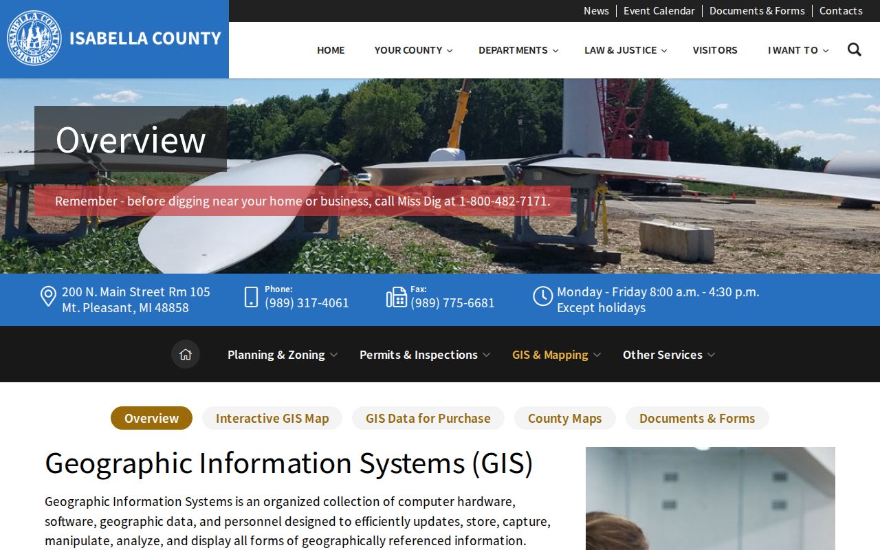
When comparing lots along a street, record the map date and theme, then distinguish a parcel next to another parcel from a street address nearby. A large parcel can touch more than one road, and a road centerline may not be the legal boundary. If the relationship matters, use the deed or plat and ask the GIS or assessor office which layer is current.
Follow a Mount Pleasant Address Into Deeds
The Register of Deeds is the recorded-instrument custodian for deeds, mortgages, assignments, liens, plats, surveys, and related land records. Its land-record search guidance supports name, date, liber or page searching and identifies a tract-index route for account users. The Quick Search accepts a grantor, grantee, subdivision, document type, or document number, with recorded-date presets, custom dates, index-only or index-plus-OCR options. Advanced Search adds Party, Grantor, Grantee, document types, book, liber, page, OCR phrase, and freeform, subdivision, section, or condo legal fields.
- Parcel
- The property identifier used to keep the street search tied to one mapped unit.
- Situs address
- The physical location used for the property, which can differ from a mailing address.
- Plat
- A mapped subdivision or lot reference. The county warns that a plat book is a generalized snapshot, not boundary evidence.
- Criss-cross directory
- The street-order portion of a directory, often used to find a dated household clue by address.
Isabella Real Property Quick Search exposes the term, date and index or OCR controls used to begin an instrument search.
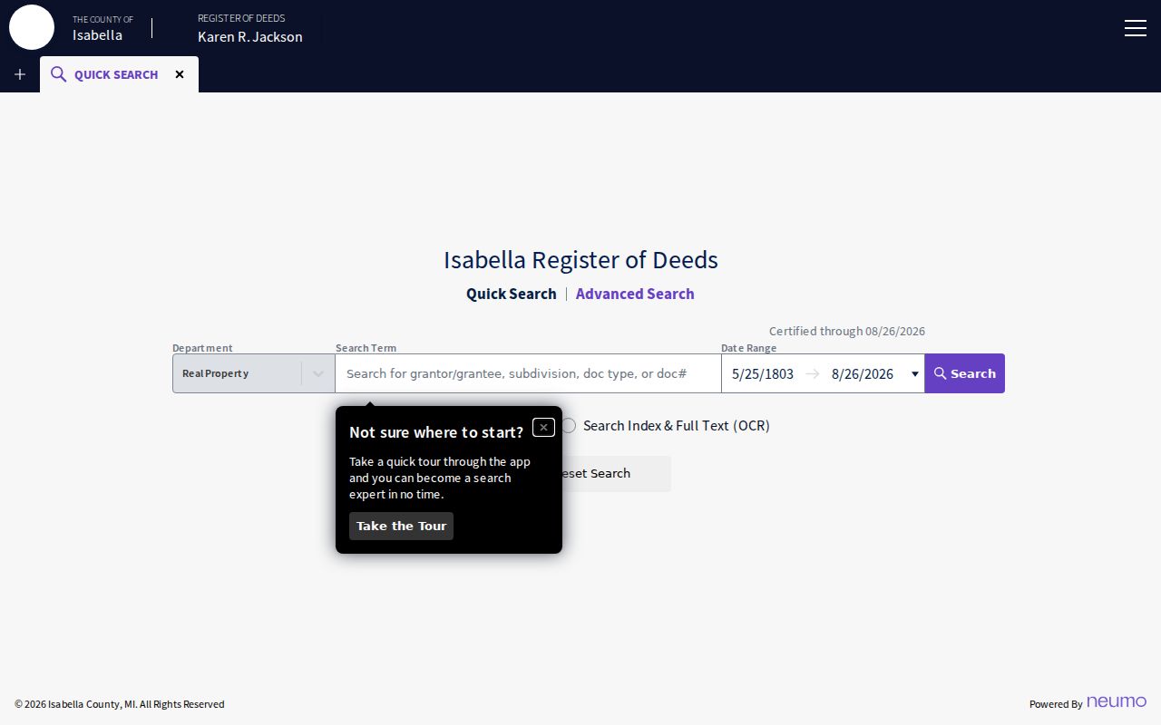
The quick form helps establish a document lead. The portal displayed certification text during research, but its current earliest complete online year was not stated. A 2022 county report says deeds, surveys, and land corners had been imaged and indexed back to 1940, while pre-1940 mortgage and miscellaneous material was still being indexed. That project status is not a guarantee that every older item is searchable online.
Isabella Real Property Advanced Search provides the party, date, document, book, legal-type, and full-text controls for a more focused address trail.
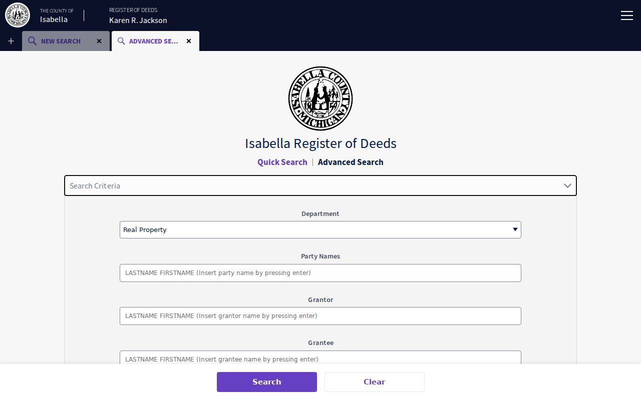
For a missing older instrument, use the Register of Deeds counter, the tract-index account route, paper books, plat books, the Archives of Michigan guide, and local historical collections. The office is at 200 N Main St, Room 220, Mount Pleasant, with 989-317-4089 and registerofdeeds@isabellacounty.org listed in the records map. Printed-copy guidance described $1 per page, but current copy and recording charges should be confirmed before payment.
Compare Mount Pleasant Street Records
One street can appear in several custodians' systems, each answering a narrower question. The table separates the keys, access routes, and limits so that an owner, a parcel, a project participant, and a registered voter are not silently treated as the same person. Begin with the source closest to the question, then keep the record date with every note.
| Address record | Custodian | What the street search can show | Access channel |
|---|---|---|---|
| Parcel, assessment and tax | City BS&A, Treasurer, assessor | Parcel number, property class, tax or assessment values and owner or taxpayer fields. | Online address, name or parcel search; city contact; county Treasurer route. |
| Parcel map | Isabella County GIS | Outline, road setting, adjacent labels and available map-report fields. | FetchGIS; GIS office and purchased data products. |
| Recorded instrument | Isabella County Register of Deeds | Parties, date, document type, number, liber or page, and legal description. | Quick or Advanced online index; counter; tract index; paper and archive fallback. |
| Permit or site plan | City Building Safety or Planning | Jobsite, owner, applicant, contractor, project and status if releasable. | City custodian or a focused city FOIA request. |
| Election record | City Clerk, County Clerk, Michigan SOS | Registration or public QVF fields subject to protected-field limits. | Michigan.gov/Vote for an individual workflow; QVF FOIA request for a defined dataset. |
| Historic directory or paper | CRDL, Clarke and library collections | Dated address, household, occupation, organization or event clue. | Library databases, microfilm, digitized papers, holdings and archive assistance. |
Note: A current parcel owner, a directory-listed household, and a registration address are separate dated relationships.
Use Mount Pleasant Permit Records Carefully
Municipal building records are address-centered, but they are project records. The city application asks for project location or street address, business name, subdivision, lot dimensions, owner, applicant, contractor, professional-license information, project type, construction type, occupancy, area, and cost. A permit can connect a street to a person involved with work on a specific date. It does not prove completion, occupancy, or a present household.
For a city-held permit, incident, cemetery, or administrative record not available online, the City Clerk is the practical FOIA intake. The city accepts a written request by hand delivery or mail to 320 W Broadway, email to clerk@mt-pleasant.org, fax at 989-773-4691, or its Jotform. Describe the date range, street, record type, and known permit or incident number. Police records have a separate public-safety FOIA route, and city building jurisdiction should be confirmed before a request because county building coverage differs from city coverage.
Find Earlier Mount Pleasant Street Listings
Historic address work belongs on a different track from current parcel research. Luedders' 1930 directory has alphabetical, street, and classified navigation, while the NPS downtown bibliography identifies Mount Pleasant directory years from 1925-26 through 1998 with gaps. Later Bresser criss-cross directories may show a street or address, head of household, phone, owner or renter notation, first year listed, and relocation clues when a holding includes that edition. The legend in the actual volume controls the meaning of any abbreviation.
Luedders' 1930 Mount Pleasant city directory archive presents the historical directory's street and alphabetical paths. Use a directory entry as a dated household clue, then corroborate it with a newspaper image, census, permit, deed, or cemetery source as appropriate. CRDL points to local newspapers, yearbooks, directories, and an obituary index; Clarke and Veterans Memorial Library provide a path to microfilm-indexed papers when a web search does not produce the relevant image.
Mount Pleasant Fires and Addition Names
Address changes can reflect the built environment as much as a person's move. The downtown historic-district research names Bentley's Addition from 1867, Smith or Hopkins from 1875, and Kinney from 1877. It also records a narrow-gauge railroad in 1879 and standard gauge in 1884. Search subdivision, lot, block, railroad, and legal-description terms alongside a street name when an older address does not match a modern number cleanly.
The 1875 downtown fire, the 1882 fire south of Broadway, and the 1895 fire west of Bennett are useful date markers. Sanborn runs from 1884, 1890, 1895, 1900, 1910, 1924, 1931, and 1950 can help align the building footprint before and after a fire. They explain a building or use, not a current resident relationship.
Keep Mount Pleasant Voter Searches Narrow
Michigan Voter Information Center and Michigan.gov/Vote provide the individual registration and local-clerk route. A wider voter-file question belongs in a Michigan QVF FOIA request, not a street-by-street roster. The form can define state, county, jurisdiction, district, ward, precinct, registration, history, cancellation, inactive, or absent-voter data. It provides delivery by encrypted flash drive, optional FTP, or Bureau pickup, not email delivery.
Michigan makes voter-registration records public through FOIA but excludes driver or state ID number, month and day of birth, phone number, application office or type, and refusal-to-register information. A QVF result can contain residence or mailing address if available, year of birth, registration date or status, voter ID, and history. A registration entry does not prove current presence, ownership, or household composition. The Isabella County Clerk and Mount Pleasant City Clerk can help identify the correct local election custodian.
Respect Limits of a Mount Pleasant Street Directory
No public street directory establishes every occupant of a home. Deeds show a recorded legal interest, maps show spatial context, permits show a project connection, directories show a dated listing, and voter records follow their own public-field rules. Michigan's Address Confidentiality Program can provide eligible participants a substitute address. A public record should never be used to reverse that address or identify a confidential location. Ask the custodian to apply exemptions or redactions when making a focused Michigan Freedom of Information Act request.
When a result is wrong, retain the citation and ask the assessor, clerk, Register of Deeds, or court custodian for correction or annotation. A missing or redacted item is not evidence that the named person has no record. If a question concerns immediate danger, use emergency services rather than an address search.